Mavic 2 Pro/Zoom User Manual
Flight Parameter Settings
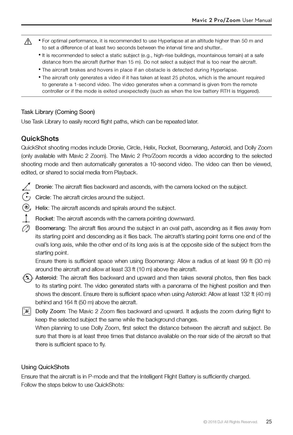
1. Flight Speed: Flight speed range is 0-10 m/s, the “+” value means the aircraft circles the point
counter-clockwise, and the “–” value means the aircraft circles the point clockwise. Adjust the speed
by sliding the onscreen slider, and use the roll stick on the remote controller to increase the value.
2. Circle Radius: Adjust the radius by sliding the onscreen slider, and use the tilt stick on the remote
controller to increase the value.
3. Circle Attitude: Adjust the attitude by sliding the onscreen slider, and use the throttle stick on the
remote controller to increase the value.
4. Gimbal Angle: Use the yaw stick to control the gimbal’s yaw, and use the gimbal dial to control the
gimbal’s tilt. Tap the icon to recenter the gimbal (If GPS Positioning is used to select the Point of
Interest, only the yaw recenters. If the Point of Interest is selected on the screen, both the yaw and
tilt recenter).
5. Circle Direction: Select the direction by sliding the onscreen button.
Exiting Point of Interest
Tap on the screen or press the Flight Pause button to pause the Point of Interest mode. Press and
hold on the Flight Pause button to exit Point of Interest mode.
The aircraft brakes and hovers in place once an obstacle is detected during POI.
If the aircraft nose is aimed towards the Point of Interest during flight, the aircraft may not be
able to avoid obstacles. Use Point of Interest in a wide open area.
Waypoints (Coming Soon)
The aircraft flies to the waypoints in order according to the settings. The flight orientation and speed
can be controlled during flight. You can select the waypoints by flying the Mavic 2 Pro/Zoom to the
waypoints and record them individually. The waypoints can also be selected and edited in the map
before takeoff:
1. Add Waypoints and Point of Interest in the map. The aircraft’s camera points to the Point of Interest
when traveling through the waypoints.
2. Tap on the Waypoints and Point of Interest to set the altitude, flight speed, and other parameters.
3. Drag the Waypoints and Point of Interest to adjust the positions.
4. Flight speed, failsafe settings, and aircraft behavior can be configured after completing the
Waypoints.
5. Waypoints and Point of Interest information can be saved in the app while editing in the map and the
flight path can be recorded and repeated.
In challenging environments such as those surrounded by high-rise buildings it is recommended
to set waypoints by flying to each waypoint manually.
30 © 2018 DJI All Rights Reserved.
 25
25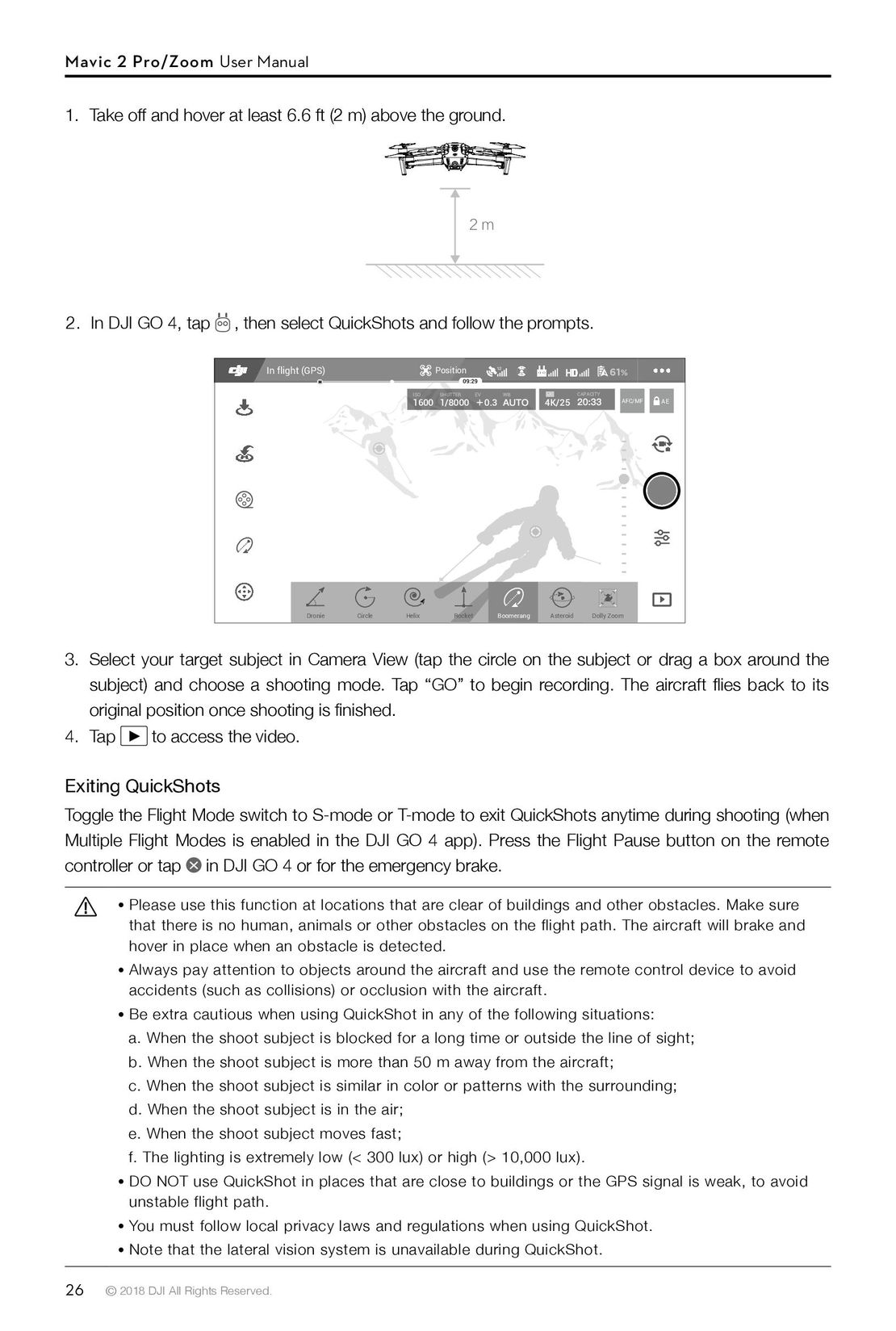 26
26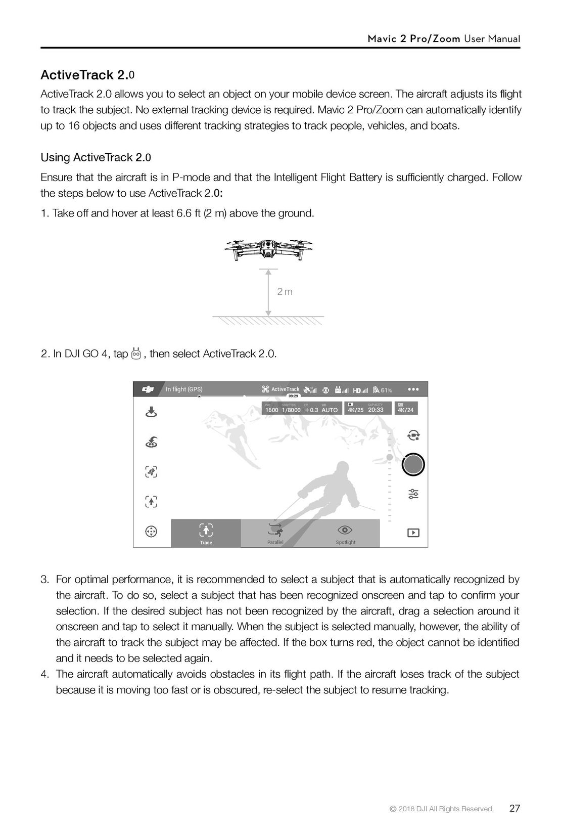 27
27 28
28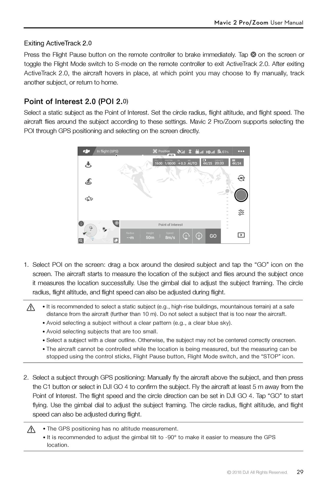 29
29 31
31 32
32 33
33 34
34 35
35 DJI Phantom 3 Standard инструкция на русском
 DJI Phantom 4 Pro Plus инструкция на русском
 DJI Phantom 3 Advanced инструкция на русском
 Syma X54HW X54HC инструкция на русском
 Syma X5UW инструкция на русском
 DJI Mavic Pro и Pro Platinum инструкция на русском